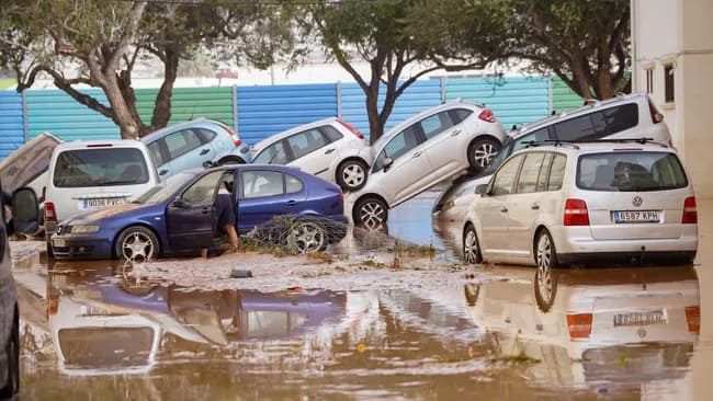
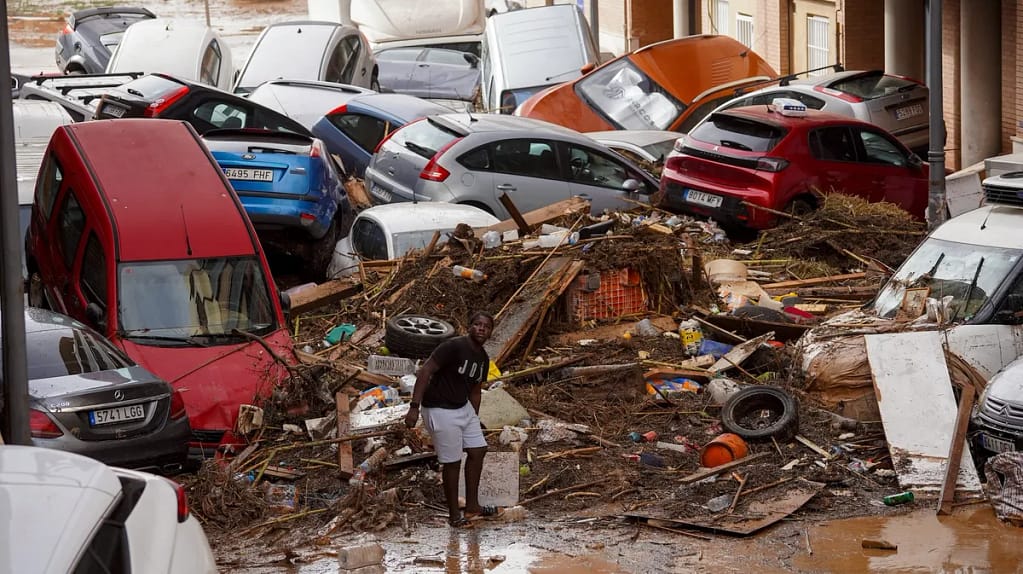
This week, Valencia, Spain, experienced devastating flash floods due to an odd weather phenomenon called a DANA. Meteorologists are describing the natural disaster as one of the deadliest in recent memory, with over 155 people dead and others still missing.

Massive flooding that destroyed entire towns and left thousands stranded occurred on Tuesday, October 29, after some places received the equivalent of a year’s worth of rainfall in a matter of hours. Rainfall totaled up to 20 inches (500 liters per square meter) in some places.
Depresión Aislada en Niveles Altos (DANA), which means isolated depression at high levels in Spanish, is a phenomenon that occurs in the Mediterranean and is the source of this catastrophic weather. Spain’s State Meteorological Agency (Aemet) said it was the worst DANA in the 21st century, on par with the disastrous “Pantanada de Tous” in 1982.
What is a DANA?
DANAs are heightened forms of a “cold drop,” which happens at an altitude of around 29,500 feet (9,000 meters) when a mass of warm air collides with a stagnant mass of cold air.
A powerful wind current encircles Earth like a belt in the upper atmosphere. Occasionally, this current starts to fluctuate, taking on the appearance of a snake rather than a belt. This can cause the oscillation to become “stuck,” which would allow the mass of cold air to stay in one spot. This time, it took place in southeast Spain.
When this cold air meets extremely warm air close to the surface, particularly over the Mediterranean’s warm waters, a DANA happens. The warm air rises readily and becomes saturated with water vapor as a result of this combination, which also produces a notable temperature differential between the atmosphere’s layers.
Heavy storms and torrential rain are the result of combining this temperature difference with humidity and energy from the Mediterranean, which is extremely warm after the summer months.

In just a few hours, the storm dumped an entire year’s worth of rain, killing over 155 people and seriously damaging property. (Photo courtesy of Getty Images/Anadolu))
DANAs are among the most hazardous weather events in Spain, according to geoscientist Iago Pérez of the University of Oxford, who also noted that “they release enormous quantities of water in a very short time.”
According to the researchers, extratropical cyclones, which are similar weather patterns, originate in the Atlantic off Uruguay and Argentina, while DANAs exclusively form over Spain.
The DANA’s most intense day of the weather phenomenon, which is predicted to persist with decreased intensity until Sunday (Nov. 3), occurred on October 29, when it hovered over the same location for nearly 12 hours.
According to meteorologist Mar Gómez, DANAs use warm water as “fuel,” as she told Live Science.
Off the coast of Valencia, the DANA found water temperatures of about 72 degrees Fahrenheit (22 degrees Celsius), which is warmer than the typical temperature for this time of year, which is about 70 degrees Fahrenheit (21 degrees Celsius). Even though that difference might not seem like much, it is sufficient to give the storm system more energy. This has the potential to “trigger a cascade of rainfall in a very short period,” according to Olcina.”These rains can be characterized as monsoonal.”
What does climate change have to do with it?
Olcina and Gómez concur that climate change has a direct impact on how severe this week’s DANA is. However, Pérez believes a more thorough examination is necessary before attributing the occurrence to global warming.
One of the marine basins that has warmed the most in recent decades is the Mediterranean Sea. They serve as a “transmission belt for humidity and energy,” according to Olcina. The average Mediterranean temperature has risen by 2.7 F (1.5 C) during the 1980s, nearly twice as much as the region’s air temperature has grown during that time. “Since 2020, summers on the Iberian Peninsula have seen record temperatures, and this year, sea surface temperatures have exceeded 84.2 F [29 C]” stated Olcina.
The Mediterranean now starts to warm in May and continues to do so until November, changing the timing of DANAs. In contrast, this phenomenon typically happened in September and October during the 1980s and 1990s. Compared to 60 years ago, an estimated 15% to 20% more DANAs form annually today.
This episode provides valuable insights for researchers, starting with the necessity of enhancing early warning communication methods.
“When people die, it indicates that something went wrong. “We need to improve communication and anticipation of these events,” Gómez said.
More frequent, severe, and unusual precipitation events are probably going to be fueled by climate change. According to Olcina, this emphasizes how urgently prevention and protection systems must be modified and susceptible areas must be reorganized in order to lower the risks brought on by an increasingly harsh climate.